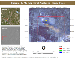
In our lab this week we delved more into Multispectral Analysis involving Thermal Imagery in order to learn how to interpret radiant energy.
Using both ArcMap and ERDAS Imagine, I was able to create two different composite multispectral satellite images from TIFF files.
For the final map assignment, I used the composite image created in Exercise 2 of this lab which I compiled in ERDAS Imagine. I had already identified a big fire site and then happened to find another one further down the image. As means to highlight the fire I modified the RGB bands to R-2, G-3, B-5 in the Landsat 4 TM satellite image. This made surrounding vegetation a dull blue while making the fire and its smoke orange.


Comments
Post a Comment