Module11- Sharing Tools
This module served very much as a review in Script Tools. The assignment required that we edit an existing script to work with data provided, edit parameter details for the tool to become more user friendly, then finalize it by embedding the script into the tool and creating a password for it.
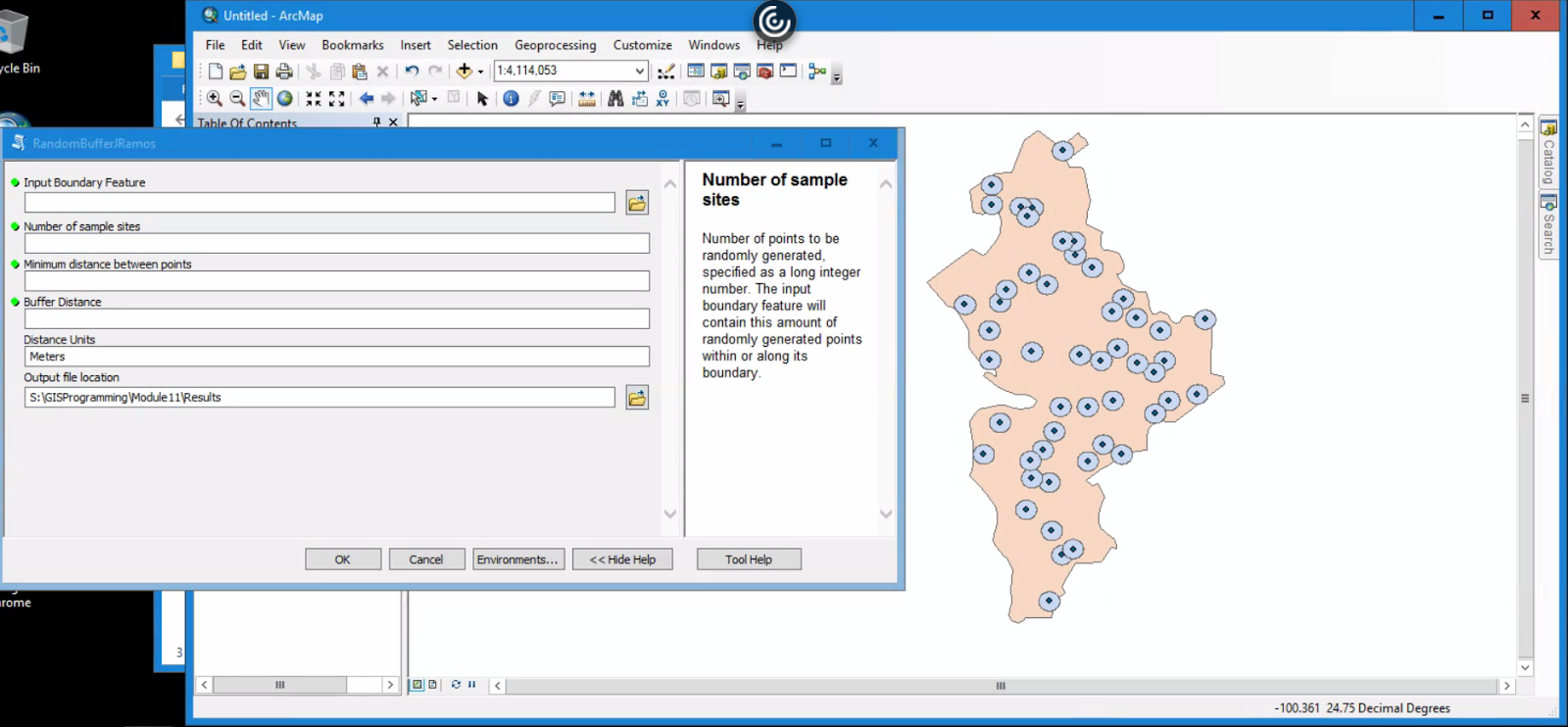
This is the final outcome of tool. It was supposed to create randomized points with buffers within the feature boundary.
Below is a flowchart displaying basic steps taken to create and share this Script Tool.

...and that's a wrap!
This was the last module for GIS Programming course. I still have the final project to complete for next week. While it's not the end yet, there is a sense of accomplishment in having made it this far in a course I thought I would perform terribly in. All modules focused on Python fundamentals were very challenging for me but also the most rewarding once I figured things out. It was really helpful being familiar with how certain tools work in ArcMap to get a better idea of what my approach to code logic should be when scripting.
Module 7: Exploring and Manipulating Spatial Data was very interesting to me because it was extremely challenging and tested what I had absorbed so far. Getting into the habit of writing out pseudocode and inserting print statements every step saved me from unnecessary headaches. There were a lot of specific processes in steps and you really could not move on until each step worked as expected.


Comments
Post a Comment