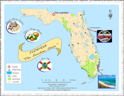
Module 2- Introduction to Adobe Illustrator
This week we explored utilizing both ArcMap and Adobe Illustrator to create and enhance a basic map of Florida for a children's encyclopedia. I wound up spending a lot more time on this assignment than expected since it was my first time enhancing a map from ArcMap. Layers needed some readjusting before I felt comfortable adding graphics. Color scheme wise, I decided to keep it light and simple, it's for kids after all. That dictated the choice of font and border style used as well as the title. There were a lot of images in this map that could drown out the title. So I figured it was best to make a banner for it to stand out.
This is actually the second map because while working through the lab document the first time, I realized that my initial Florida map layout did not suit the layout I worked towards in AI. When I was ready to work on a finalized version, knowing the audience and content required drove the layout.
This is actually the second map because while working through the lab document the first time, I realized that my initial Florida map layout did not suit the layout I worked towards in AI. When I was ready to work on a finalized version, knowing the audience and content required drove the layout.


Comments
Post a Comment